Log in
All resources
Create a design
371 Free Artworks of Italian Language Maps
bibliothèque nationale de france
marco boschini
context files from gallica
maps of the islands of greece by marco boschini (1658)
italia - di matteo greuter - btv1b53041991c
maps of ports and fortresses of the mediterranean by marco boschini (1651)
1744 fleurons
navigantium atque itinerantium bibliotheca
4 gravures représentant la guerre entre les vénitiens et les turcs autour de corfou sur une feuille - btv1b8493378g
maps by emanuel bowen
maps of ports and fortresses of the mediterranean by marco boschini (1651)
bibliothèque nationale de france
context files from gallica
history of andros
maps of the islands of greece by marco boschini (1658)
context files from gallica
maps of the islands of greece by marco boschini (1658)
history of anafi
context files from gallica
history of amorgos
maps of the islands of greece by marco boschini (1658)
history of ios
maps of the islands of greece by marco boschini (1658)
history of tilos
maps of the islands of greece by marco boschini (1658)
history of leros
maps of the islands of greece by marco boschini (1658)
history of naxos
maps of the islands of greece by marco boschini (1658)
history of paros
maps of the islands of greece by marco boschini (1658)
history of patmos
maps of the islands of greece by marco boschini (1658)
context files from gallica
maps of the islands of greece by marco boschini (1658)
history of kythnos
maps of the islands of greece by marco boschini (1658)
history of kalymnos
maps of the islands of greece by marco boschini (1658)
context files from gallica
maps of the islands of greece by marco boschini (1658)
history of milos
maps of the islands of greece by marco boschini (1658)
history of nisyros
maps of the islands of greece by marco boschini (1658)
history of mykonos
maps of ports and fortresses of the mediterranean by marco boschini (1651)
bibliothèque nationale de france
old maps of bologna
gregorio monari
maps by emanuel bowen
1744 fleurons
maps by pieter mortier
maps from gallica
maps of the islands of greece by marco boschini (1658)
history of chalki
context files from gallica
crete under venetian rule
maps of the islands of greece by marco boschini (1658)
context files from gallica
bibliothèque nationale de france
niccolo nelli
maps of ports and fortresses of the mediterranean by marco boschini (1651)
bibliothèque nationale de france
map of the circle of swabia by sanson
bibliothèque nationale de france
bibliothèque nationale de france
ambroise tardieu
maps of ports and fortresses of the mediterranean by marco boschini (1651)
bibliothèque nationale de france
maps by nicolas sanson
1720s maps of france
maps of ports and fortresses of the mediterranean by marco boschini (1651)
bibliothèque nationale de france
map of the circle of lower saxony by sanson
bibliothèque nationale de france
maps of ports and fortresses of the mediterranean by marco boschini (1651)
bibliothèque nationale de france
maps of the islands of greece by marco boschini (1658)
context files from gallica
italia - di matteo greuter - btv1b53041991c
bibliothèque nationale de france
nelle presenti tre tavole sono descritte le marine secondo le carte da navicar et fra terra secondo i migliori scrittori antichi et moderni, con fumi, monti, laghi, mari, citta, provincie et capi principale... - btv1b8468487h
bibliothèque nationale de france
italia - di matteo greuter - btv1b53041991c
bibliothèque nationale de france
italia - di matteo greuter - btv1b53041991c
bibliothèque nationale de france
italia - di matteo greuter - btv1b53041991c
bibliothèque nationale de france
italia - di matteo greuter - btv1b53041991c
bibliothèque nationale de france
italia - di matteo greuter - btv1b53041991c
bibliothèque nationale de france
italia - di matteo greuter - btv1b53041991c
bibliothèque nationale de france
italia - di matteo greuter - btv1b53041991c
bibliothèque nationale de france
bibliothèque nationale de france
niccolo nelli
italia - di matteo greuter - btv1b53041991c
bibliothèque nationale de france
nelle presenti tre tavole sono descritte le marine secondo le carte da navicar et fra terra secondo i migliori scrittori antichi et moderni, con fumi, monti, laghi, mari, citta, provincie et capi principale... - btv1b8468487h
bibliothèque nationale de france
nelle presenti tre tavole sono descritte le marine secondo le carte da navicar et fra terra secondo i migliori scrittori antichi et moderni, con fumi, monti, laghi, mari, citta, provincie et capi principale... - btv1b8468487h
bibliothèque nationale de france
old maps of duchy of cleves
guillaume sanson
italia - di matteo greuter - btv1b53041991c
bibliothèque nationale de france
italia - di matteo greuter - btv1b53041991c
bibliothèque nationale de france
italia - di matteo greuter - btv1b53041991c
bibliothèque nationale de france
le marquisat et eslectorat de brandebourg qui fait partie du cercle de la haute saxe divisé en ses principales marches... - par le sieur sanson ; cordier sculpsit - btv1b532025368
sanson maps of the circles of germany
bibliothèque nationale de france
sanson map of lorraine
carte des alpes by guillaume sanson (1690)
bibliothèque nationale de france
l'espagne divisée by guillaume sanson
1680s maps of the iberian peninsula
bibliothèque nationale de france
niccolo nelli
maps of ports and fortresses of the mediterranean by marco boschini (1651)
bibliothèque nationale de france
le cercle de franconie, subdivisé en touts les estats qui le composent, dressé sur les mémoires les plus nouveaux - par le sr. sanson... - btv1b53202321v
map of the circle of franconia by sanson
carte des alpes by guillaume sanson (1690)
bibliothèque nationale de france
carte des alpes by guillaume sanson (1690)
bibliothèque nationale de france
navigantium atque itinerantium bibliotheca
1744 fleurons
map of the circle of westfalia by sanson
louis cordier
le duché de poméranie compris sous le cercle de la haute-saxe divisé suivant qu'il est présentement partagé entre la couronne de suède et l'eslecteur de brandebourg, où sont les duchés de... - btv1b53202543b
sanson maps of the circles of germany
map of the circle of bavaria by sanson
louis cordier
navigantium atque itinerantium bibliotheca
1744 fleurons
german renaissance
1744 fleurons
4 gravures représentant la guerre entre les vénitiens et les turcs autour de corfou sur une feuille - btv1b8493378g
old maps of corfu
4 gravures représentant la guerre entre les vénitiens et les turcs autour de corfou sur une feuille - btv1b8493378g
old maps of corfu
4 gravures représentant la guerre entre les vénitiens et les turcs autour de corfou sur une feuille - btv1b8493378g
maps of corfu by braun & hogenberg
4 gravures représentant la guerre entre les vénitiens et les turcs autour de corfou sur une feuille - btv1b8493378g
old maps of corfu
301 - 371 of 371
/ 4


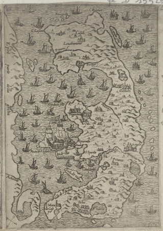
![Isolette [Raclia, Schinussa, etc] / Marco Boschini, 1658](https://cdn.creazilla.com/illustrations/10001438226/isolette-raclia-schinussa-etc-marco-boschini-1658-sm.webp)